Rising seas and statehood: the UN declaration
LeadPrelims and MainsSeptember 2026
Why in news
On 24 September 2026 the United Nations General Assembly adopted its first declaration on sea level rise, and agreed to hold another high level meeting by September 2030.
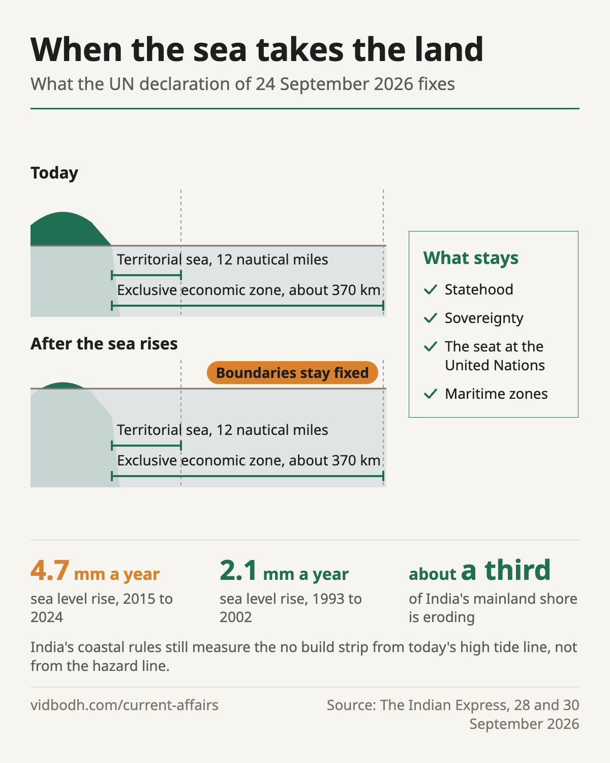
- 4.7 mm a yearglobal rate of sea level rise, 2015 to 2024
- 2.1 mm a yearthe rate in 1993 to 2002
- 11,098 kmIndia's coastline
- 1,298India's offshore islands
- about a thirdof India's mainland shore that eroded between 1990 and 2016
Background
- The sea rises for two reasons, melting ice and the thermal expansion of warming water, and it is measured by satellite altimetry together with tide gauges.
- The Montevideo Convention, 1933 says a State needs a permanent population, a defined territory, a government and the capacity to enter into relations with other States.
What the declaration settles
- It affirms a presumption of continued statehood: losing territory to the sea does not end a State's existence, its sovereignty or its seat at the United Nations.
- Maritime boundaries stay fixed, so the 12 nautical mile territorial sea and the exclusive economic zone of about 370 km do not shrink as the coast retreats.
India's stake
- India backed fixed boundaries abroad, and it has its own exposure in 1,298 offshore islands and a coastline of 11,098 km.
- The National Centre for Coastal Research found about a third of the mainland shore eroding between 1990 and 2016, and over 170 km in West Bengal is retreating by more than 5 m a year.
The gap at home
- The Coastal Regulation Zone notification of 2019 measures its no build strip, of 50 m or 200 m, from today's high tide line.
- The Survey of India's hazard line does account for sea level rise and shoreline change, but it is used only for disaster and land use planning.
- India has no law for people displaced slowly by erosion, of the kind Fiji passed in 2021.
Two lines on India's coast
| High tide line | Hazard line | |
|---|---|---|
| What it is | today's high tide line | a line mapped by the Survey of India |
| Accounts for sea level rise | no | yes |
| Used for | the no build strip of 50 m or 200 m | disaster and land use planning only |
The way forward
- Measure the no build strip from the hazard line, so that the rule moves with the shore.
- Legislate for people displaced slowly by erosion, as Fiji did in 2021.
- Press for adaptation finance for coasts that are already eroding.
Prelims facts
- The declaration was adopted by the General Assembly on 24 September 2026.
- The four Montevideo criteria: population, territory, government, capacity for relations.
- The hazard line is mapped by the Survey of India; the high tide line is what the coastal zone rules use.
- Sea level is measured by satellite altimetry and tide gauges.
See also: Coastal adaptation: seawalls, mangroves and managed retreat
Sources: The Indian Express, 30 Sep 2026: Experts Explain | What the UN sea level declaration means for the world — and India's eroding coast (opens in a new tab) · The Indian Express, 28 Sep 2026
Earlier coverage: The UN declaration on sea level rise and statehood · The monthly magazine, September 2026